

Technology
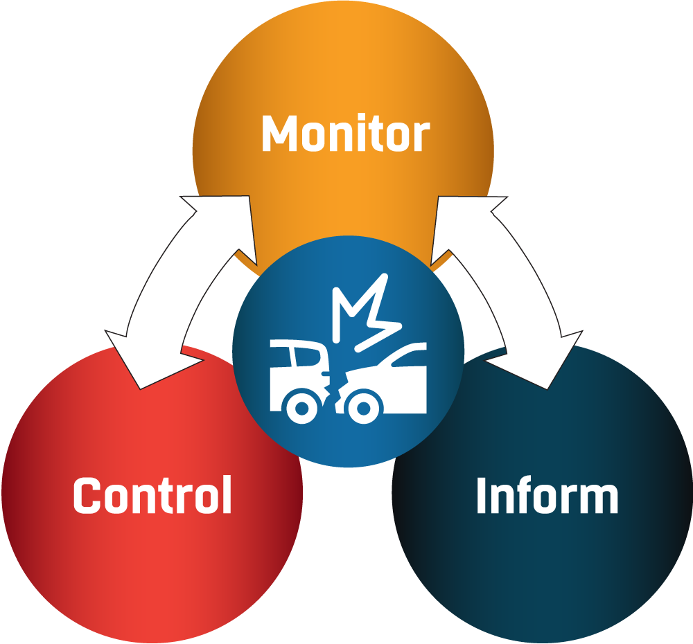 Advances in technology are continuously leading to innovations in transportation management. DelDOT’s integrated transportation management system (ITMS) includes technology and telecommunications that are used to monitor and control the transportation system, as well as disseminate information to travelers.
Monitor
TMC staff monitor the transportation system 24 hours a day, 365 days a year. The TMC receives information from its own DelDOT sources, police and fire departments, and the public.
Report an Issue

DelDOT encourages travelers to enhance the monitoring system by reporting issues. You can report issues on the telephone, by email, or with a form available both on the website and on the DelDOT App. Thank you for taking time to contribute!
Computer-Aided Dispatch (CAD)
Centralized statewide control and management of the Computer Aided Dispatch (CAD) to CAD connections with County Emergency Operations Centers (EOCs) and State Police.
DelDOT receives notifications from public safety answer points (PSAPs) of incidents affecting the transportation system.
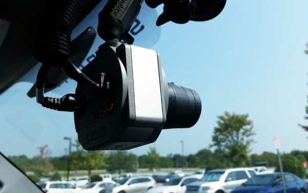
Dash Cam
A dashboard camera is attached to a vehicle, used to capture live video and/or still photos.
Camera feeds from the vehicle are monitored in real-time and allow TMC technicians to view an area if there is an incident, weather, or road safety issue.
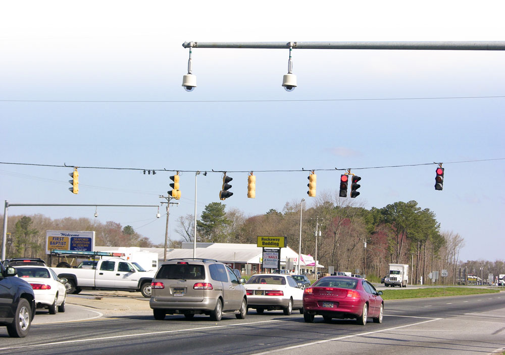
Fixed Video Cameras
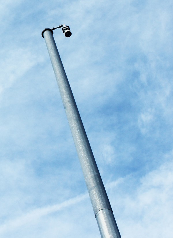 Video is primarily used for monitoring of current traffic conditions and verifying roadway incidents, such as:
- Crashes
- Disabled Vehicles
- Construction
- Maintenance activity
Cameras are placed high above the roadway, located in areas to provide line of sight to view other nearby traffic control devices.
Roadway Weather Information System (RWIS)
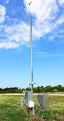 RWIS measures atmospheric, pavement and water level conditions including:
- Air temperature
- Surface and sub-surface temperature
- Dew temperature
- Relative humidity
- Wind direction
- Wind speed
- Wind gust
- Visibility
- Precipitation
Environmental Sensor Stations (ESS) in the field, a communication system for data transfer and central systems collecting field data from numerous ESS come together to measure atmospheric, pavement and/or water level conditions
Hydrology Monitoring System
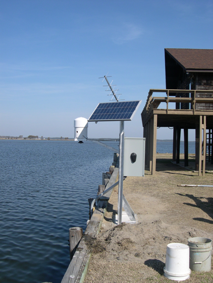
The system is composed of a group of stations (gauges) that are designed and operated to make observations about flooding and/or erosion. The system monitors rainfall events, high flow events and erosion
Signal System Detectors
 Signal system loops collect real-time data along signalized corridors to provide the TMC with current traffic volumes. The information collected provides the TMC and signal controller unit with current traffic volumes along the corridor and can be used to determine signal-timings.
Radar Detection
 Microwave Detection (Wavetronix) detects vehicles by lane, provides real-time traffic volume, speed and delay to the TMC, and classifies vehicles by length. Each detector is positioned adjacent to the road, non-intrusive to traffic. Changes in real-time data indicate to TMC technicians of lane blockages and roadway issues.
Detectors are spaced methodically to allow for the accurate calculation of travel time and delay. Vehicle length measurements are correlated to the FHWA vehicle classification system.
Bluetooth Detection
Bluetooth detectors detect electronic signals that are being emitted from discoverable Bluetooth devices within vehicles as the vehicles pass a Bluetooth monitoring station. This technology is used to garner real-time travel information on:
- Average travel times
- Average travel speeds
- Average travel patterns
A vehicle containing a detectable Bluetooth device is observed at two stations. The Media Access Control (MAC) address and time of detection are logged, and the information is used to obtain a sample travel time for the segment.
Control
Computerized traffic signals, managed lanes and variable speed limit signs are some ways the TMC adjusts traffic control for safety and mobility. The TMC works closely with responders and calls in equipment as needed.
Variable Speed Limit Sign
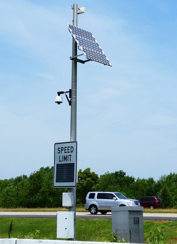
VSL signs allow the TMC to remotely adjust the posted speed limit along a corridor based on road, traffic, and weather conditions. Electronic signs slow traffic ahead of congestion or bad weather to increase traffic flow, lessen stop-and-go conditions, and reduce risk of crashes.
TMC technicians manage variable speed limits based on roadway conditions and input from law enforcement. Variable speed limit signs are placed in accordance with the DE MUTCD and follow the same standards required for static SPEED LIMIT (R2-1) signs.
Computerized Traffic Signals
Traffic signals are monitored and adjusted to serve changing patterns based on volume and speed data.
High-Intensity Crosswalk Signals
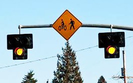 HAWK signals are high-intensity beacons triggered by pedestrian requests at crosswalks to stop road traffic to allow pedestrians to cross safely.
Weigh Station
A weigh station is a checkpoint along a highway to inspect the weight of trucks and commercial vehicles.
Weigh-in-motion technology is used to screen trucks for weight. Truck weight triggers a signal light indicating that the driver should pull over for further inspection. Vehicles within the weight restrictions are signaled to proceed back to the highway.

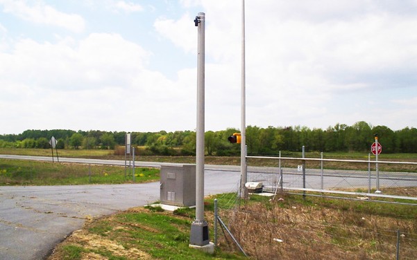
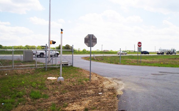
Emergency Access Gate Control System
Emergency Access Gate Control Systems are located along limited access roadways (I-495, SR 1) that can be opened when needed to provide access for incident management and maintenance activities.
Emergency Access Gates can be opened remotely by the TMC or on-site by emergency vehicle Opticom sensors.
Inform
The TMC provides real-time information to enable the traveling public to make informed decisions regarding travel route, travel time and mode choice. The information is all accessible through the DelDOT App, interactive map, radio and signs. The TMC also communicates frequently with partners within DelDOT and externally with other agencies.
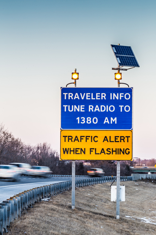
Traffic Advisory Radio (WTMC 1380 AM and 98.5 FM)
DelDOT’s designated AM radio frequency (WTMC 1380 AM and 98.5 FM) updates travelers on roadway and transit conditions allowing drivers to make informed decisions regarding travel plans. The main transmission tower is located in New Castle and there are numerous repeater sites throughout New Castle, Kent and Sussex counties.
Mobile App
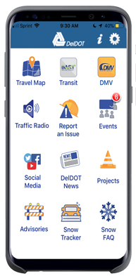
DelDOT has an app that can be downloaded onto both Android and Apple devices. The DelDOT App provides real-time information for Delaware’s transportation system, including traffic advisories, traffic cameras, traffic maps and more. Users can now use features such as an interactive project map, DMV driver license practice test, and a place to report streetlight outages.
Interactive Maps
Much of the information DelDOT gathers for transportation system management is shared with the public in real-time on the interactive map. View DelDOT’s interactive travel map to experience a real-time view of the transportation network throughout Delaware. Explore the map features by choosing map layers from the menu. For more details on each layer, click on the layer’s info icon.
Variable Message Signs
Electronic traveler information signs are used to provide information in support of incident management, construction activities, adverse environmental conditions, and changes in traffic patterns and special events.
Traveler information is pushed from the TMC to both permanent and portable signs.